Your World in 3D. Now Accessible.
The EOS2 LiDAR sensor is the powerful, low-cost 3D scanner designed for hobbyists, students, and creators. Stop dreaming and start mapping.
What Will You Create?
The EOS2 LiDAR is perfect for your projects. Its low cost opens up a world of possibilities for 3D mapping. See how our users are using it.
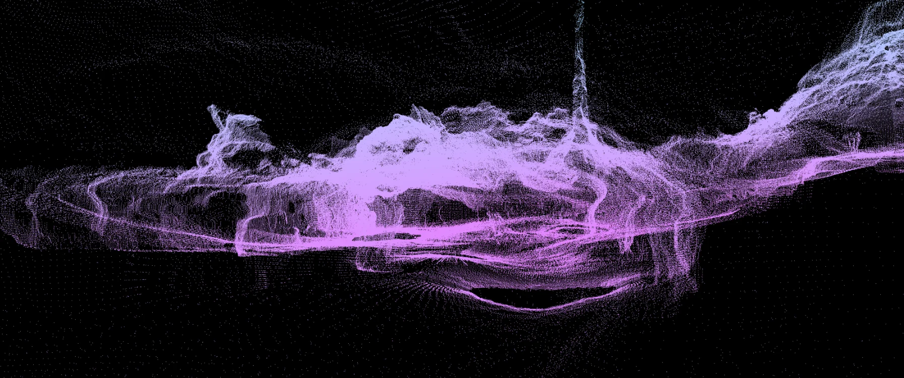
Volumetric Cave Mapping
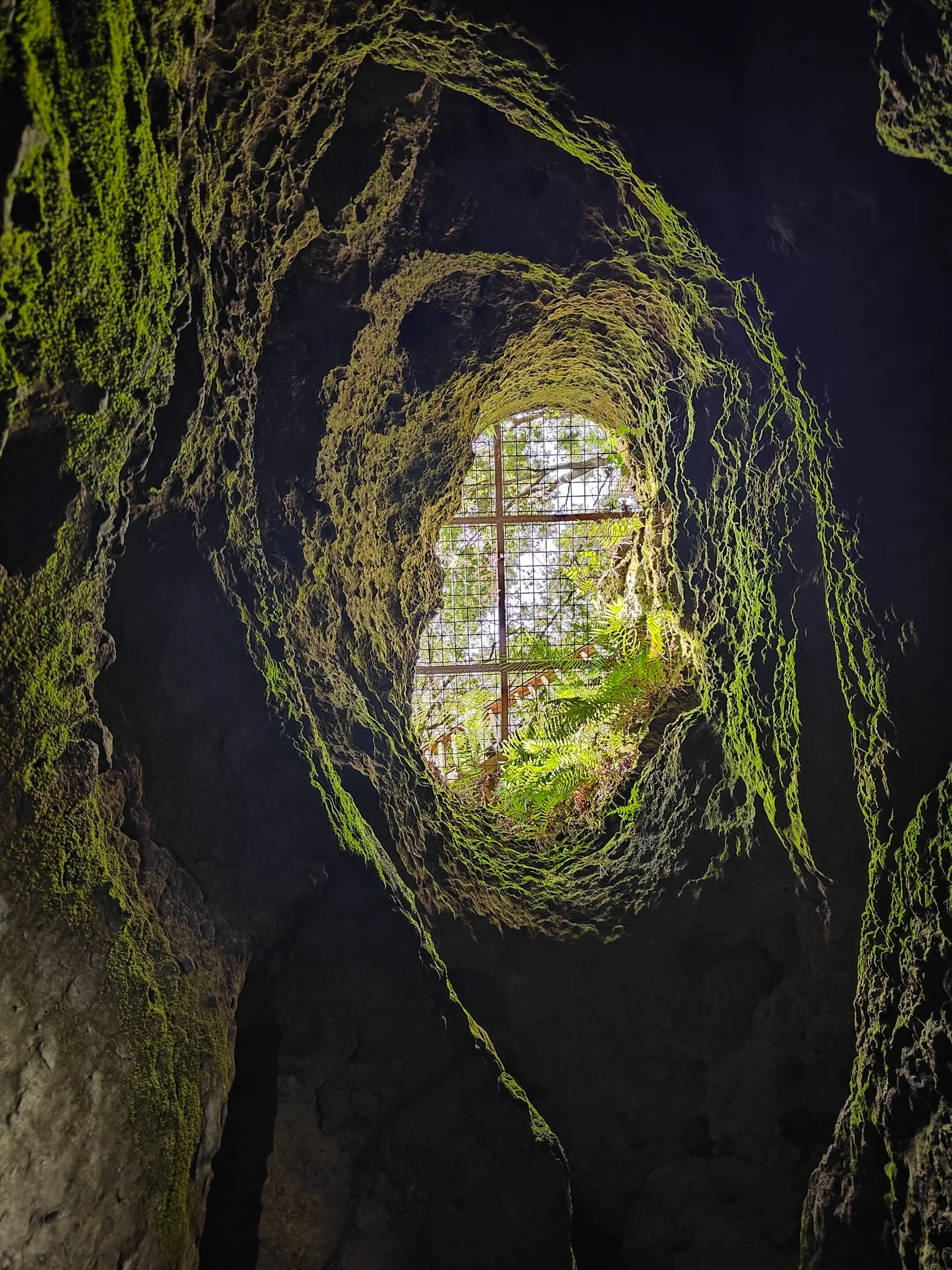
Imagine exploring a cave and taking home a perfect 3D model! Our sensor is light and robust enough to join your adventures. Using our "Bat Cave" asset, you can see how LiDAR captures every crack and corner, creating a complete volumetric map that even the best photo couldn't achieve. It's ideal for speleology, documentation, and virtual exploration.
Share your explorations with the world in 3D, measure volumes with precision, or simply keep a digital record of your favorite places.
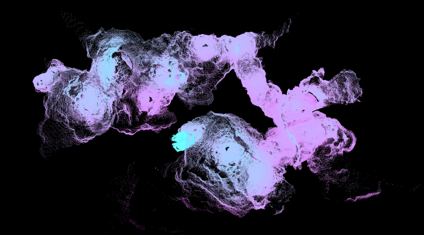
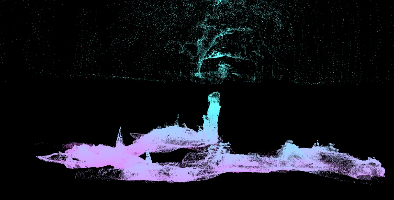
Bird's-eye 3D render of the "Bat Cave".
Digitize Your Home & Yard
Planning a renovation? Want to install a wooden shed in the backyard? With the EOS2 LiDAR, you can scan your backyard in minutes and get a to-scale 3D model. Measure distances, check slopes, and plan your project with millimeter accuracy. Forget the measuring tape and the errors.
Our backyard mapping example shows how easy it is to capture the terrain, the house, and existing trees so you can design your project on a perfect digital canvas.
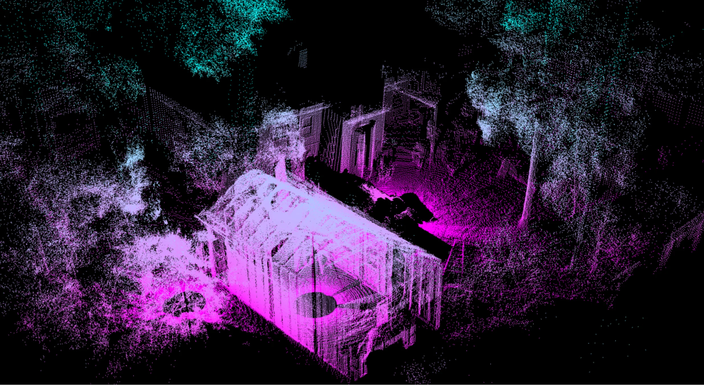
Backyard point cloud for shed planning.
The 3D Lab at Your Fingertips
For students and teachers, the EOS2 LiDAR is a revolution. Its low cost makes it accessible for digital design labs, GIS classes, or architecture projects. Students can capture real-world objects, interiors, and environments to create detailed 3D models.
It's the perfect tool to experiment with 3D data, learn about point clouds, or create custom assets for 3D printing, game development, and virtual reality projects.
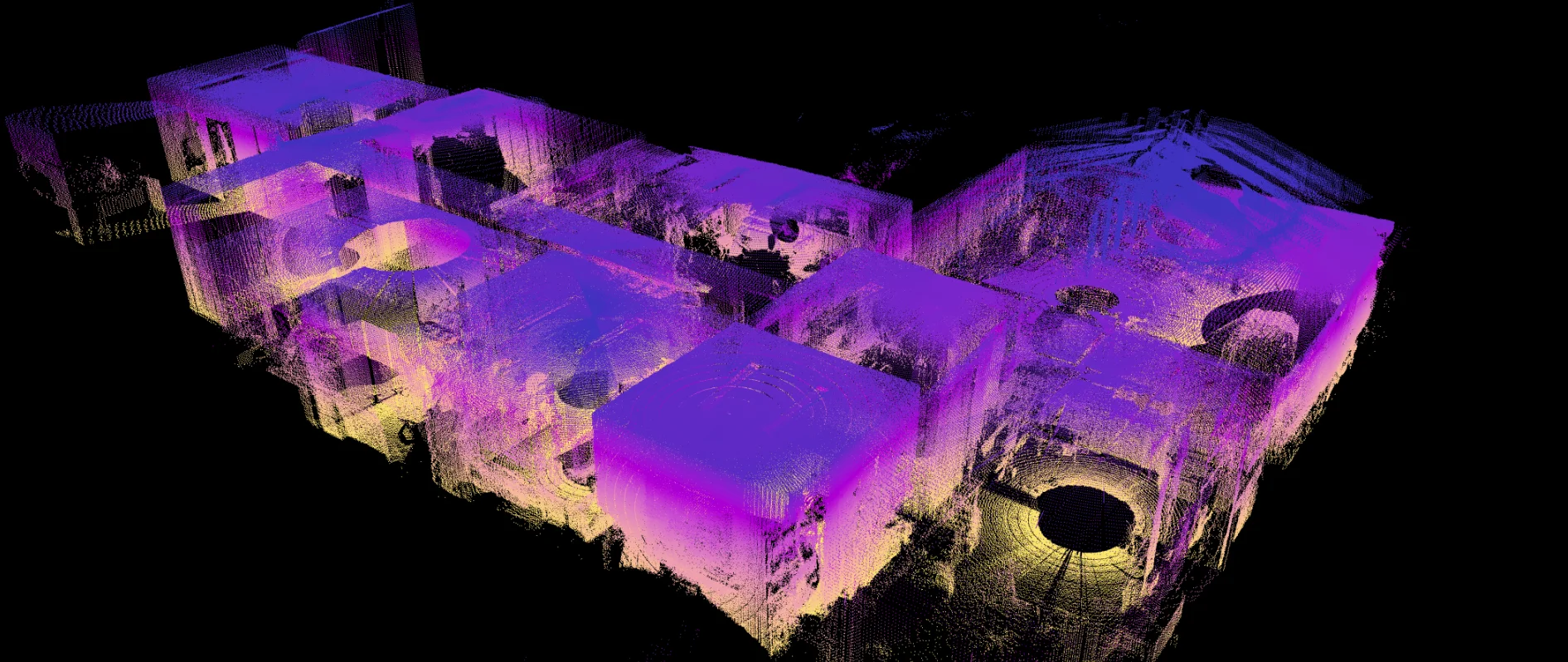
Office scan used for interior mapping and 3D modeling.
Why You Will Love EOS2
Get high-end 3D scanning without the
high-end price tag.
Finally Affordable
Stop waiting. Our sensor brings powerful 3D scanning to a price point that's perfect for your personal projects, classroom, or workshop.
Scan in Minutes
No complex setup. Connect the sensor, start your scan, and get a detailed point cloud in minutes. It's built to be plug-and-play.
Endlessly Creative
From digitizing a cave to building a 3D model, the possibilities are endless. If you can dream it, you can scan it.
Explore the 3D Scans
Click, drag, and zoom to interact with real point clouds captured by the EOS2 LiDAR. This is the raw data you get.
Bat Cave Scan
Explore the full 3D model of the bat cave. Click and drag to see the complex geometry and volumetric data captured by the sensor.
Backyard Shed Project
See how the sensor captures both the ground terrain and the house. This scan is perfect for planning, measuring, and designing home projects.
Office Interior Scan
This is the actual point cloud from our office. It's the perfect dataset for interior planning, asset creation, or measuring a space.
Who is This Sensor For?
Built for curiosity, not just for heavy industry.
Explorers & Hobbyists
Keep a 3D record of your adventures. Map caves, forests, or terrain with a portable, easy-to-use tool. Create 3D models to print, share online, or use in virtual reality.
Students & Educators
The perfect tool for 3D capture, GIS, and architecture labs. Learn and develop with real, accessible hardware, giving your projects the power of real-world 3D data.
Makers & Developers
Integrate 3D data into your projects. Ideal for custom scanning rigs, turntable scanners, or interactive art installations. Connect it easily and start receiving point cloud data right away.
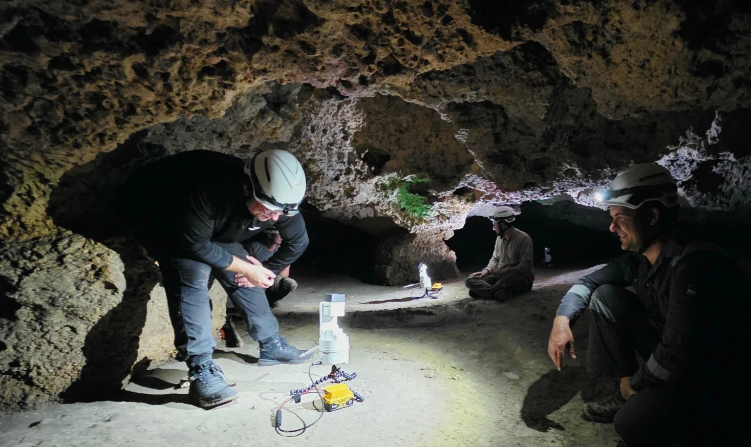
Case Study: Mapping the Bat Cave
See how a team of explorers used the low-cost EOS2 sensor to create a stunning 3D map of a complex cave system.
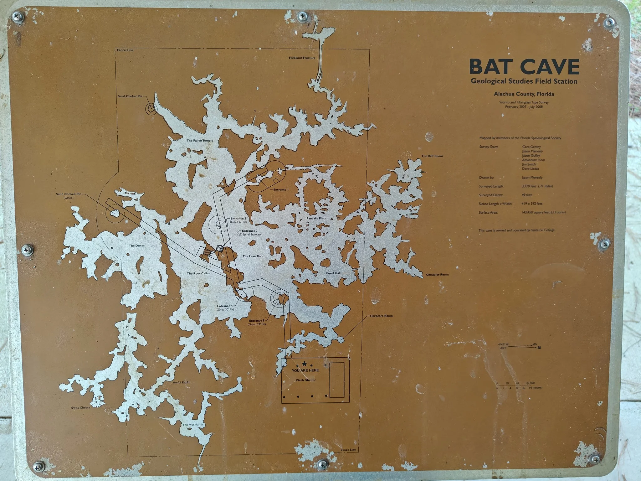
The Challenge: Mapping the Unseen
Traditional mapping (like the sign outside the cave) is flat and often inaccurate. For explorers, understanding the true 3D volume, passages, and structures is key. This was previously only possible with bulky, multi-thousand-dollar equipment.
The team's goal: create a high-fidelity 3D model on a hobbyist budget.
The Result: A Digital Twin
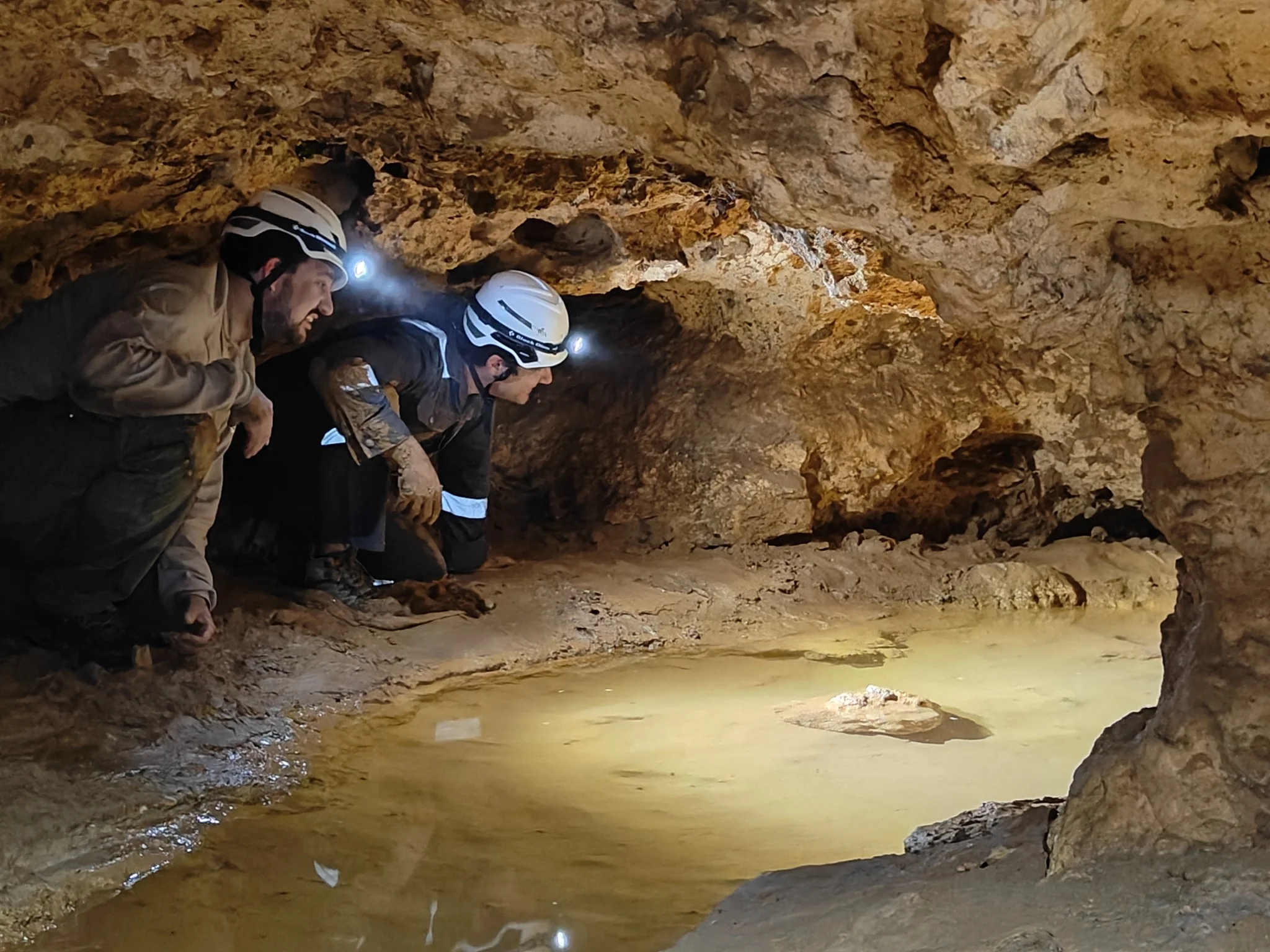
By simply walking through the cave with the portable EOS2 sensor, the team captured millions of data points. This data was stitched together to create a fully interactive, measurable, and shareable 3D model of the entire cave.
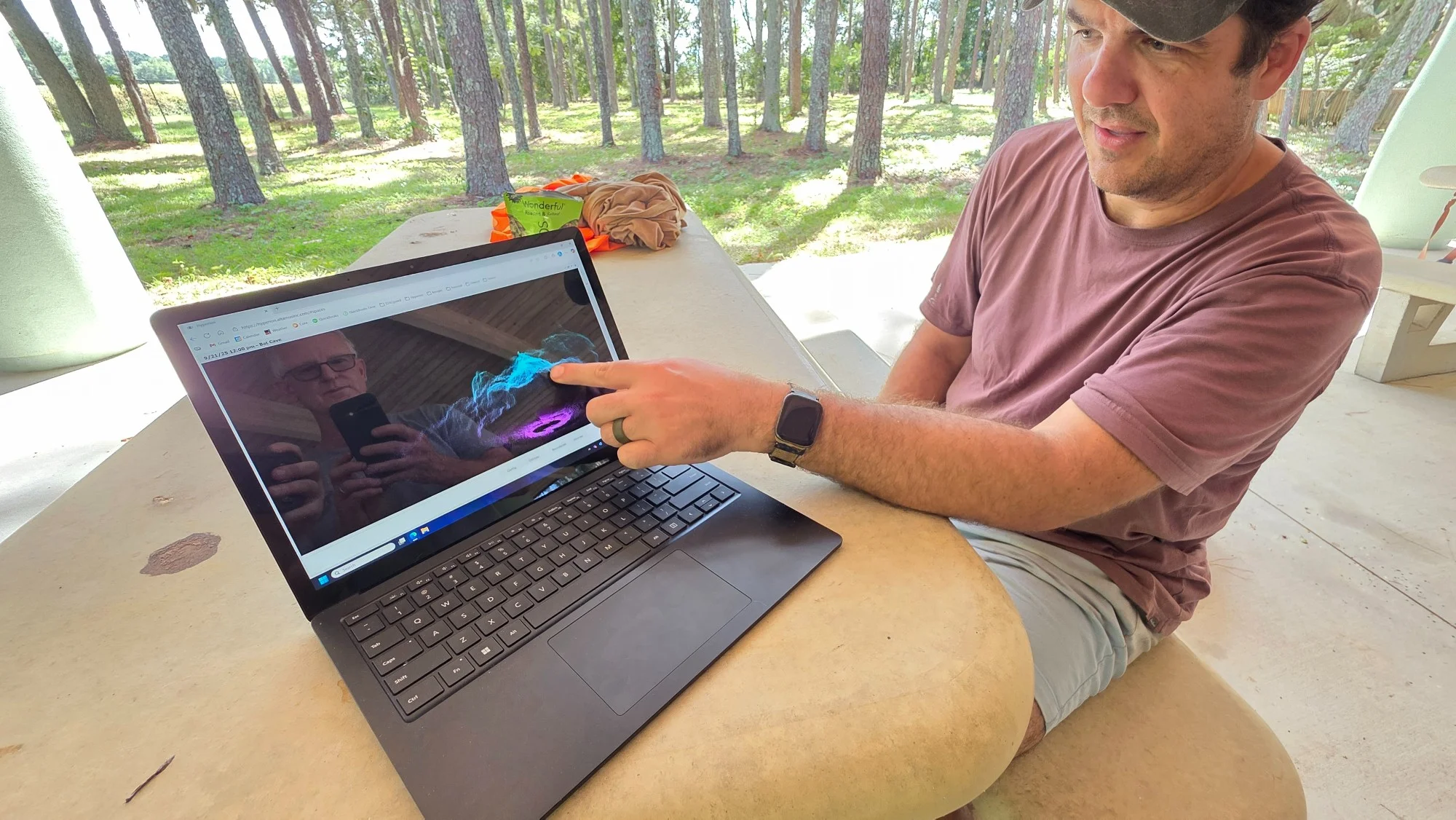
The team reviewing the final point cloud, a level of detail they had never seen before. A project that was once a dream, now a reality thanks to accessible LiDAR.
Works Best with Hyperion
Your EOS2 sensor captures the 3D data. Our Hyperion software helps you bring it to life. Easily clean, visualize, and measure your point clouds. Calculate the volume of your backyard excavation, measure the interior of a room, or process complex data for your school project. Get more from your scans.
Learn More About HyperionFrequently Asked Questions
Quick answers for your creator questions.
Not at all! We designed it with simplicity in mind. It connects easily (e.g., via USB) and is compatible with many open-source applications and libraries. If you know how to use an Arduino or Raspberry Pi, you'll feel right at home.
Besides our Hyperion software, you have many free options! The point cloud it generates is compatible with open-source software like CloudCompare (for analysis and visualization) and MeshLab (for processing and creating 3D meshes). You can also import the data into Blender, Unity, or Unreal Engine for your creative projects.
There's no catch. Traditional LiDAR sensors cost thousands of dollars because they are built for ultra-high-precision industrial applications. We focus on the essential features that hobbyists, students, and makers need. We use smart design and accessible components to give you 90% of the functionality for a fraction of the cost.
Anything you want! Once you process the point cloud and create a 3D mesh, you can: 3D print it to have a physical model of your cave or house, use it as a level in a video game (imagine playing in a map of your own backyard!), or import it into Virtual Reality (VR) software to walk "inside" your scan.
Ready to Start Scanning?
Join the community of creators, explorers, and students using the EOS2 LiDAR. Your next great 3D project is just a click away.
Get Your EOS Sensor